Cabbagetown
Located in the area bounded by Wellesley Street, Sherbourne Street, Shuter Street and the Don Valley, this unique Toronto neighbourhood contains the largest continuous area of preserved Victorian housing in North America. As such, the neighbourhood is a City-designated historical conservation district with an active community base dedicated to protecting this heritage. The Cabbagetown Preservation Association offers neighbourhood tours of some of the more significant homes of this period.
To celebrate and promote the neighbourhood’s heritage, the Cabbagetown Preservation Association has worked to name over 50 laneways after significant individuals, events, and features. Click HERE to learn more about the names of the laneways in Cabbagetown.
Cabbagetown derives its name from its original inhabitants – poor Irish immigrants who relocated to Toronto during the potato famine of the 1840s – who grew cabbages on their front yards. The original Cabbagetown was largely located in the footprint of Regent Park, which was razed in the 1940s for the construction of public housing. Over time, the name was applied to the surrounding neighbourhoods, including the area to the north which was known as Don Vale, a name which continues to this day.
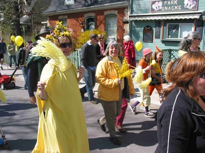
 Cabbagetown is home to a large number of housing co-operatives, housing projects and single family homes, and is a mixed income community. This diversity contributes to a vibrant arts and cultural scene which may be experienced during the annual Forsythia Festival in May and the Cabbagetown Festival and the Cabbagetown Arts and Crafts Sale in September. Regular performances are held at the Toronto Dance Theatre, the Canadian Children’s Dance Theatre, and the Cabbagetown Community Arts Centre. Parliament Street, the neighbourhood’s main street, features many small, independent businesses serving local residents and visitors.
Cabbagetown is also home to the Riverdale Farm; a unique urban feature. During the warmer months, a weekly farmers market is held at the farm which is heavily utilized by both local residents and visitors from across the city.
Cabbagetown Community Arts Centre: http://www.cabbagetownarts.org
Cabbagetown Heritage Advisory Committee: http://www.cabbagetownhcd.ca
Cabbagetown Preservation Association: http://www.cabbagetownpa.ca
Cabbagetown South: http://www.cabbagetownsouth.ca
Canadian Children’s Dance Theatre: http://www.ccdt.org
Don Vale Cabbagetown Residents Association: http://www.donvalecra.ca
Friends of Riverdale Farm: http://www.friendsofriverdalefarm.com
Old Cabbagetown BIA: http://www.oldcabbagetown.com
Riverdale Farm: http://www.toronto.ca/parks/riverdalefarm.htm
Toronto Dance Theatre: http://www.tdt.org
——————————
Corktown
One of Toronto’s Old Town neighbourhoods, Corktown’s character draws from its many layers of history.
Corktown’s modern history is associated with the industrial development of Toronto.
In the 19th Century, many residents found employment at one of the local breweries or brickyards. Some of the workers’ cottages and rowhouses are still to be found along the network of small, fine grained streets such as Bright Street, Trinity Street, Wilkins Avenue, Ashby Place and Percy Street. With these residents came the construction of heritage sites such as St. Paul’s Basilica, Little Trinity Church, and the Enoch Turner Schoolhouse. Among the notable stories to come from this period was that of Toronto’s first taxi service, created by Thornton and Lucie Blackburn after they escaped slavery in the US.
In the early 1960s, a significant amount of Corktown was demolished to make way for several elevated roadways, including the Richmond Street off-ramp and the Eastern Avenue overpass. However, a landmark battle to preserve residences around Trefann Court successfully saved portions of the neighbourhood.
Corktown remains a small scale neighbourhood that is experiencing infill development as the area’s unique qualities and location are being recognized. The revitalization of the nearby West Don Lands and Regent Park are also ensuring this distinct neighbourhood will have even stronger connections to the city.
Corktown Residents and Business Association: http://www.corktown.ca
Old Town Toronto: http://www.oldtowntoronto1793.com
——————————
Gooderham & Worts Neighbourhood
Named for the original owners of what is now the Distillery District, this rapidly evolving community is a very special mix of residential and the revitalized historical precinct.
The Distillery, built by Gooderham and Worts, flourished into the early 20th Century but began to diminish its production until it closed entirely in the 1990s. Fortunately, during that time, the original buildings remained intact. Declared a National Historical Site, it is now one of the best preserved collections of Victorian industrial architecture in North America.
With no sources of heritage funding during the recession of the 1990s, the City granted development permissions on the site in exchange for renewal of its buildings. A number of initiatives failed to make the distillery site viable until the arrival of Cityscape in 2002. This led to the revitalization of the district as a hub for arts, culture, concerts and events. The site drew in Artscape, which provides affordable studios for visual, design, and music/dance artists, and later added Soulpepper’s Young Centre for the Performing Arts, in partnership with George Brown College.
Residential development came to the area in the early 2000s when Options for Homes constructed three affordable ownership buildings around what was still an abandoned site. Residents soon created a closely knit community that became active on local and city-wide issues. Development on the Distillery site is adding new neighbours to this growing area.
With plans moving ahead on the nearby West Don Lands development, the Gooderham & Worts community is now embracing the upcoming arrival of a whole new neighbourhood on its edges- plans that will connect great transit, residences, parks and open spaces to this unique area.
Artscape: http://www.torontoartscape.on.ca
The Distillery District: http://www.thedistillerydistrict.com
Gooderham & Worts Neighbourhood Association: http://www.gwna.ca
Old Town Toronto: http://www.oldtowntoronto1793.com
Soulpepper: http://www.soulpepper.ca
Young Centre for the Performing Arts: http://www.youngcentre.ca
——————————
Regent Park
Regent Park, located within the boundaries of Gerrard Street, River Street, Shuter Street and Parliament Street, is the City’s oldest social housing project, constructed in the 1940s in the neighbourhood that was originally known as Cabbagetown. Originally intended as a transitional community for those on social assistance or low-income workers paying rent geared to income, Regent Park has evolved into largely a newcomers settlement community.
 Despite obstacles related to concentrated poverty and poor urban design, Regent Park is a vibrant community with active participation in community and residential associations and groups. The Regent Park Neighbourhood Initiative, the Toronto Community Housing Tenant’s Council, and Parents for Better Beginnings are just some of the groups that host numerous events and activities each year for residents, such as Sunday in the Park – a community festival held each June.
Arts and culture are also alive and healthy in Regent Park. The Regent Park Focus Youth Media Arts Centre is home to Regent Park TV, an internet based broadcast hosting programming created and produced by local youth. Regent Park is also home to the Regent Park Film Festival held each November, showcasing a selection of local and international films.
Recently, the City of Toronto along with the Toronto Community Housing Corporation has undertaken the revitalization of Regent Park. Existing buildings are gradually being demolished and rebuilt as a mixed-income community. Over the next decade, the existing rent geared to income units are being replaced along with introducing new market units. Click HERE to read Councillor McConnell’s speech on Regent Park’s revitalization.
Daniels Spectrum: http://regentparkarts.ca/
Regent Park (TCHC website): http://www.regentpark.ca
Regent Park Community Health Centre: http://www.regentparkchc.org
Regent Park Focus Youth Media Arts Centre: http://www.catchdaflava.com
Regent Park Neighbourhood Initiative: http://www.rpni.org
——————————
St. James Town
St. James Town is a high-rise community located within the area bounded by Howard Street, Parliament Street, Wellesley Street and Sherbourne Street. Constructed in the late 1960’s, St. James Town’s 19 massive towers represent Canada’s largest high rise community, and one of the densest neighbourhoods in North America. St. James Town is predominately low-income with a mixture of public and private housing.
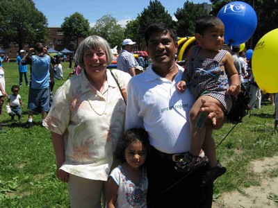
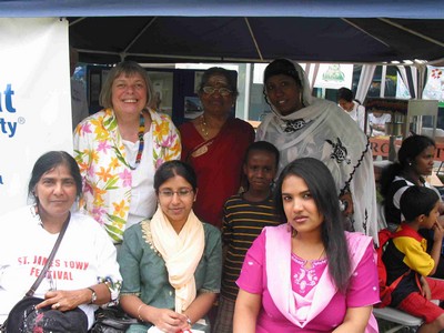
 The towers are home to many of Toronto’s newcomers, and its diversity is embraced with a strong sense of pride in the community. This is highlighted every year at the St. James Town Festival held in June. However, St. James Town has long faced significant challenges related to its density and lack of amenities. Recently the City of Toronto has made attempts to remedy this with the opening of the Wellesley Community Centre and St. James Town Public Library in 2004.
This video from The STEPS Initiaitve about their mural project with the St. James Town community.
North of Howard Street are remnants of the original Victorian housing which was razed during the “blockbusting” of the 1960s to make way for the towers. The corner of Glen Road and Howard Street is an architectural gem that is largely hidden from view from the bustling traffic on Bloor Street and Sherbourne Street. The City is undertaking to preserve and protect these houses from further deterioration and plans are underway to revitalize this intersection in order to make it a destination.
South of Wellesley Street was also razed during the late 1960’s with plans for further expansion of the towers. However, civic activism prevailed and halted the construction. In its place, a number of co-operative housing projects were developed.
St. James Town Initiative: http://sjtinitiative.com
——————————
St. Lawrence Neighbourhood
Considered by many to be a model urban community, St. Lawrence Neighbourhood is a vibrant mix of residential and commercial uses.
Its residential heart is based around the successful mix of co-op, non-profit, subsidized and condominium housing initiated in the 1970s. Comprised mainly of low rise buildings and rowhouses, this area is tied together by the Esplanade promenade and David Crombie Park. Central to the neighbourhood is the St Lawrence Market precinct, which includes the weekly farmers and antique market, and the surrounding business area, which is an attractive destination of restaurants and shops. The western end is anchored by the cultural centres of the St. Lawrence Centre for the Arts and the Sony Centre.
St. Lawrence also encompasses the original ten blocks of Toronto’s Old Town and includes some of the city’s most prominent historical sites. The First Parliament site, the Gooderham Flatiron Building, St. James Cathedral and the St. Lawrence Hall intermingle with other historical buildings from the early 20th and late 19th centuries throughout the area.
This mix of old and new, and the quality of the varied uses and spaces in the area has ensured that St. Lawrence remains a neighbourhood best enjoyed at the street level – whether sitting, walking, rolling, or biking.
This video, produced by the City of Toronto, traces the history of the St. Lawrence Market and the Market Gallery.
Old Town Toronto: http://www.oldtowntoronto1793.com
St. Lawrence Market: http://www.stlawrencemarket.com
St. Lawrence Neighbourhood Association: http://www.slna.ca
St. Lawrence BIA: http://www.stlawrencemarketbia.ca
Young People’s Theatre: http://www.youngpeoplestheatre.ca
——————————
Toronto Islands
The Toronto Islands community has a mixture of park, recreational and residential uses that make it one of the most attractive destinations in the city.
The Islands were created by sediment deposits from the erosion of the Scarborough Bluffs and were originally connected to the mainland as a spit. During the19th century, the Islands became a retreat and resort for Torontonians that featured a hotel, theatre, dance hall and amusement park. The first houses began to appear with them and a lively residential and business community arose.
In the 1950s, a policy of modernization resulted in the demolition of most of the buildings until a Provincial Act in 1993 allowed the residual properties to remain under a land trust. These 262 houses, a mix of small cottages connected in a series of cultivated and natural gardens, are clustered at the eastern end of the Islands.
Welcome to Toronto Island from Mary Partridge on Vimeo.
Along with several boating and sailing clubs, the Gibraltar Centre for the Arts, and a public and Montessori school, this community rests inside a City Park that draws over a million visitors annually, Its attractions span Centreville Amusement Park, Franklin the Turtle Children’s Garden, Gibraltar Point Lighthouse and the Island beaches.
Heritage Toronto has created an iTour of the Toronto Islands that can be used while cycling or walking, to discover the Islands’ history and its significance in Toronto’s history. Click HERE to visit the Heritage Toronto site to download the map and the video and audio tours.
Toronto Island Community: http://torontoisland.org
——————————
Waterfront Community
Queen’s Quay – Toronto’s waterfront boulevard – is a major recreation destination and home to a community that is undergoing an extraordinary transformation that will see the lakeshore live up to its promise.
In the late 19th and early 20th centuries, the lands south of the railway were literally created out of fill to allow for industrial and shipping uses. The area began to be reclaimed in the 1970s with the construction of the Harbourfront Centre, Harbour Castle Hotel and Harbour Square buildings. By the 1980s, residential development started to fill in along Queen’s Quay, along with the renovation of Queen’s Quay Terminal.
Condominium buildings with retail at grade created an increasing mix of uses on what was becoming a desirable destination. Hundreds of thousands of visitors now descend every year to enjoy the area’s numerous festivals, concerts and cultural attractions, anchored by Harbourfront Centre.
 In recent years, residential towers have risen around Lakeshore Boulevard and the Gardner Expressway. With more and more people living in the area, a new emphasis has been placed on reconnecting the waterfront with the downtown communities above the railway. A series of promenade plans have led to infrastructure and streetscape improvements to strengthen north-south pedestrian connections along York, Bay and Yonge Streets. The completion of Maple Leaf Square and the Telus office tower near the ACC will provide a new public south entrance to Union Station.
This video is an introduction to waterfront revitalization produced by Waterfront Toronto.
Meanwhile, plans have moved ahead to realize the full potential of the waterfront. The existing area from Bathurst to Jarvis will be remade with a new boardwalk at the water’s edge, decks and bridges linking the slips, and a tree lined promenade and bike path along Queen’s Quay. This transformation will help ensure Toronto’s waterfront is an extraordinary place to live, work and play.
Harbourfront Centre: http://www.harbourfrontcentre.com
Queen’s Quay Harbourfront BIA: http://www.qqhbia.com
Waterfront Toronto: http://www.waterfrontoronto.ca
York Quay Neighbourhood Association (YQNA): http://www.yqna.ca
